150x150.png)
Technologies have been used for many years to passively monitor activity on the highway, however over the years additional features have been added to assist in actively managing traffic, these range from informing users about current conditions, so that they can make their own decisions, such as automatically warning drivers of incidents using roadside variable message signs, through to compelling users to modify their driving, such as by implementing variable speed limits or by using enforcement cameras etc.
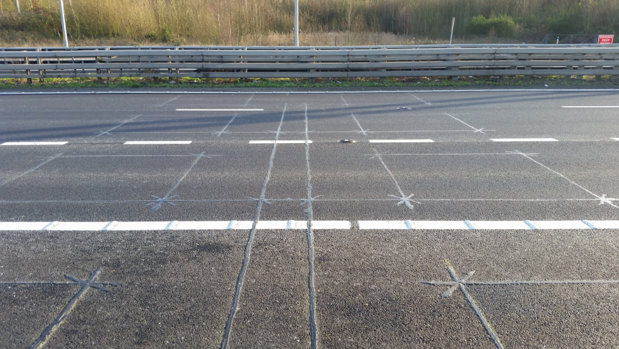
Vehicle detection is a basic building block for gathering data related to traffic. Many will be familiar with the outline of vehicle detection loops in our roads, these come in a variety of shapes and sizes depending on their use and the standards of the country being used in, but include rectangles, chevrons, circles, diamonds and even butterflies! The technology for these consists of a loop of wire slot cut into the carriageway surface, which is then sealed into place. Inductive loops work much like a handheld metal detector but are triggered by metal objects passing over the top of them. Although very reliable, loops require complete closures to allow them to be installed and suffer from reliability issues when the carriageway surface is damaged or is in poor condition. Although this technology has had widespread use since the 1960’s, it is still seen as the baseline that other technologies are measured against.
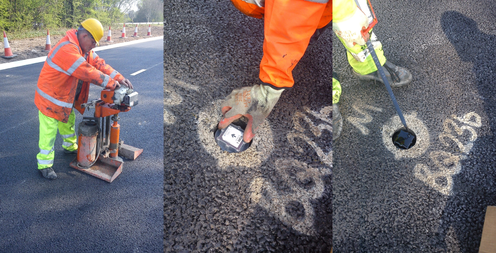
To overcome some of the issues, a range of emerging technologies have been used to detect vehicles, these include in-carriageway magnetometers, which are small battery powered wireless pucks, core drilled into the centre of each lane.
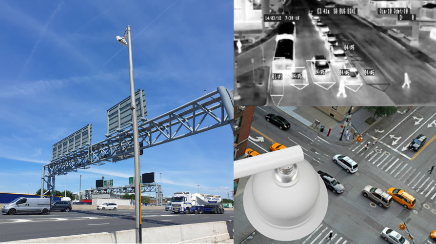
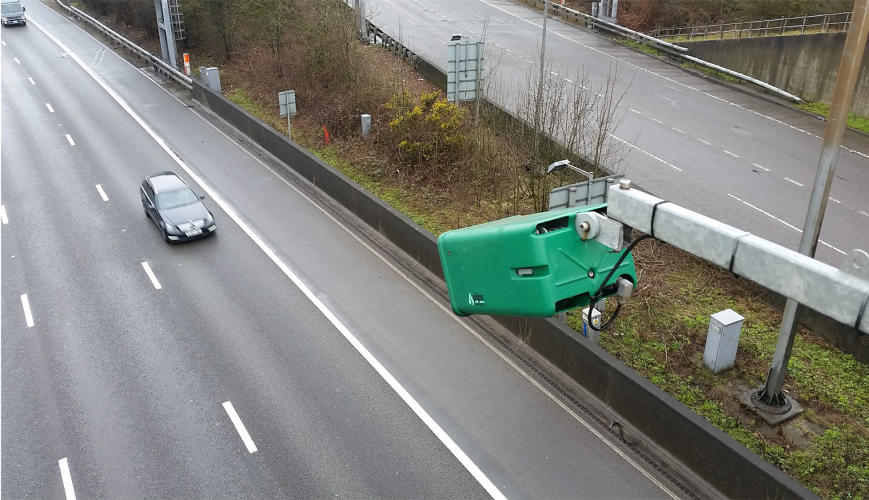
Above ground technologies, including doppler radar, thermal imaging and video analytics. These technologies are typically verge or gantry mounted, thus overcoming installation and maintenance issues in the carriageway, but suffer to some extent from obscuration or environmental intrusion, resulting in a slightly less accurate method of detection compared with inductive loops.
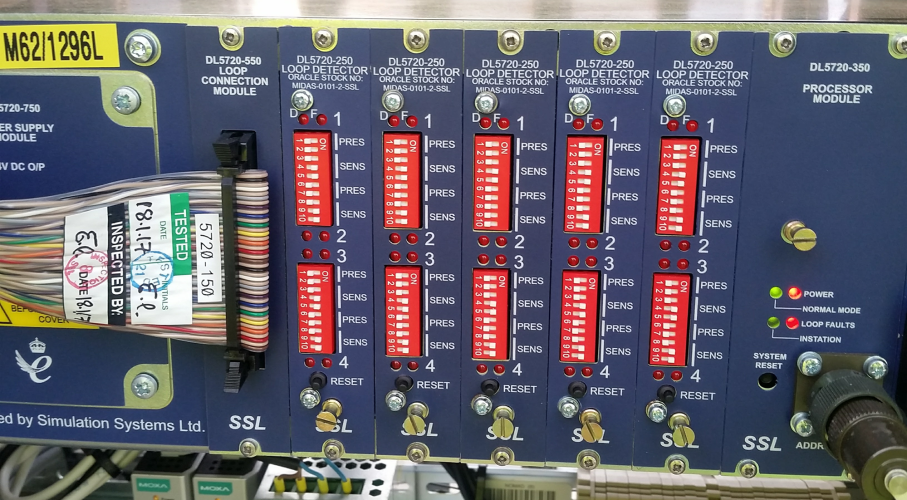
Vehicle detection is not only used to determine the presence of vehicles, such as on the approach to traffic signals, but can also be used to generate a comprehensive data set associated with traffic flow, including vehicle speed, classification of vehicle type, headway between vehicles etc. This example shows a motorway incident detection system that uses pairs of inductive loops in each lane to capture a range of data parameters and to automatically detect incidents and communicate these to the regional control centre.
Smart Motorways have gradually been introduced across the UK to provide additional traffic capacity whilst minimising the need for additional land take, by using technology to actively manage traffic flow. Technology and Systems involvement has been from the first project in the UK, where we undertook an extensive study to evaluate the performance of the operation achieved. The early design used a dynamic hard shoulder, which was only opened to traffic use during periods of congestion. However, to achieve this, it was necessary to install a comprehensive technology deployment to fully monitor the hard shoulder in order to safely open it when required or to close it in response to an incident or vehicle breakdown. The cost of the technology required to manage these implementations was very high, and the way in which the dynamic hard shoulder operated led to confusion for some drivers.
To overcome these issues, All Lane Running (referred to as ALR) Smart Motorways were introduced. Here, the hard shoulder is permanently removed and redeployed as part of the traffic lanes, typically providing four lanes open to traffic where there were only three lanes previously. These benefit from a simplified operational mode, and a reduced overall technology deployment. These have been successful in providing additional capacity and to smooth traffic flow by the use of active traffic management features.
However, there has been some criticism regarding their perceived safety, with the number and distance between emergency refuge areas (ERAs) being seen as a particular issue. These are provided to allow stranded vehicles to leave the live traffic lanes and to summon assistance. This example is in the south-eastern quadrant of the M25 orbital motorway around London, where the number of vehicles stopping on the motorway is claimed to have reduced by 95% compared with when hard shoulders existed in this section. Future projects are likely to see more frequent ERAs being provided.
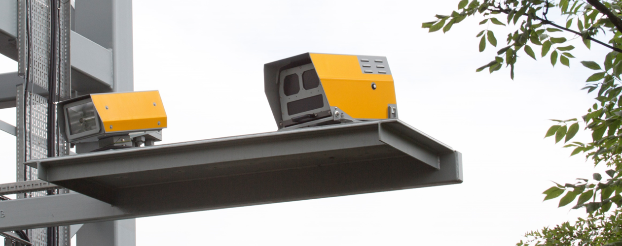
Another issue relates to vehicles stopping in a live lane, and how long it takes for this to be detected. To overcome this, dedicated Stopped Vehicle Detection (SVD) has been deployed on the M25 ALR sections to automatically detect these incidents promptly. These systems currently use scanning radar to track individual vehicle movements along a motorway section and to identify abnormal vehicle behaviour, such as stopping. These face a huge range of issues when attempting to achieve a high level of reliability particularly in high levels of traffic and within mixed vehicle use of our motorways.
It is common to see CCTV used across the world to monitor traffic flow on our highway networks. These now commonly use analytics systems to detect abnormal situations, which can then be flagged to allow a human operator to interpret any interventions which may be required.
In addition, enforcement systems are commonly used to automate compliance with traffic laws, including speed limits and traffic signal operation. In the UK, some of the current generation of digital systems used on motorways to enforce speed limits will also have the capability to enforce closed lanes (Red Exes) in response to needs to more adequately protect stranded vehicles, first responders and workforce undertaking maintenance activities. Many speed enforcement systems measure the vehicle speed in a single location at the camera site, however, newer ‘Average Speed’ systems are increasingly being used because they measure the time it takes a vehicle to travel between different camera sites, thus resulting in much higher driver compliance rather than speed surfing past camera locations.
All these systems contribute to ensuring that information provided to drivers is accurate and should be adhered to in order to ease the flow of traffic and to maximise the safety of both the travelling public and to those who work on the highway network. Information is typically provided using Variable Message Signs (VMS), which as well as text messages can now convey pictogram symbols capable of rapidly conveying information irrespective of language or even ability to read. Advisory or mandatory dynamic speed limits provide an effective means to smooth traffic flow, the impact of flow compression on average journey times is reduced and with less stop start traffic, safety is dramatically improved.
An example of an active traffic management tool is the use of Ramp Metering. These are traffic signals typically located on entry slips to motorways to breakup the flow of vehicles entering the mainline carriageway, so that flow breakdown does not occur on the motorway as a result of platoons of vehicles entering the mainline flow in close proximity. Since their original introduction in the US, these are now in use in various guises across the globe. In some locations these are in constant use 24/7, in others these are only active during set hours or when congestion starts to build. The operation of these systems typically makes use of algorithms that monitor a range of traffic parameters derived from vehicle detection on both the mainline carriageway and on the entry slips as well.
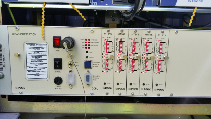
All the technology installed on the highway network tends to make use of roadside cabinets of different sizes to house associated systems and electrical / communications interfaces. Within the cabinets, a wide range of base units and controllers are housed safely out of the elements.
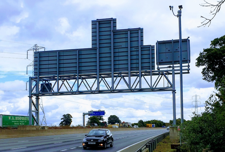
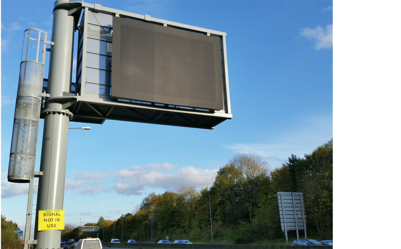
Much of the technology used on our highways has to be installed onto suitable support structures. This MS4 sign in the UK is shown on a fully accessible cantilever gantry. This allows maintenance operations to be safely carried out from within an enclosed cage at the back of the sign. This ensures that items cannot be accidentally dropped onto passing vehicles and allows maintenance to be carried out without having to close traffic lanes. These are sizeable structures, the cage is equivalent to 1.5 stories high, compared with a house, so the design of these items is no small task, for structures, civils and geotechnical disciplines.
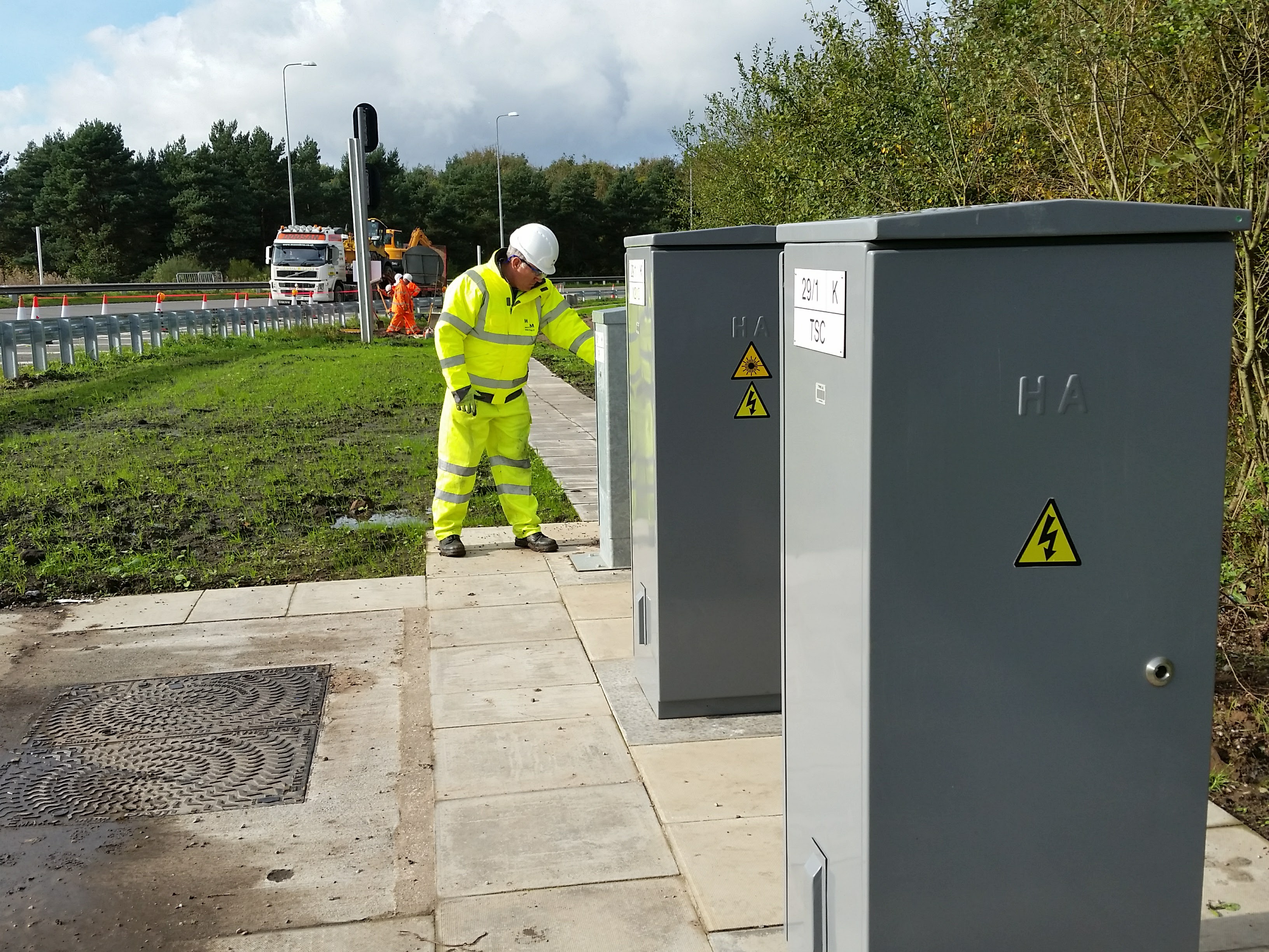
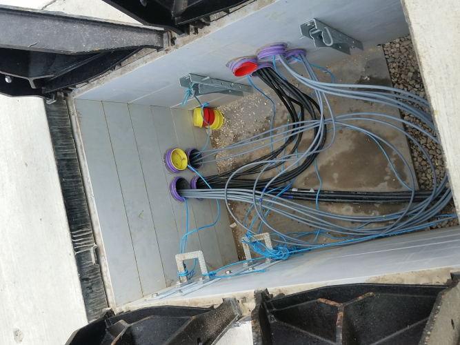
In addition, it is normal for a lot of sub-surface infrastructure to be required, such as ducts and chambers, to allow power and communications cables to be routed to different locations.
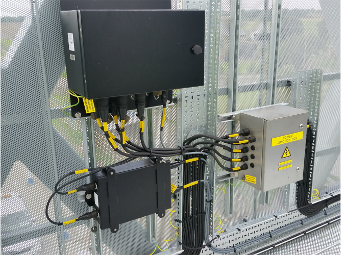
Electrical and communications circuits are also required within structures, such as this super-span gantry.
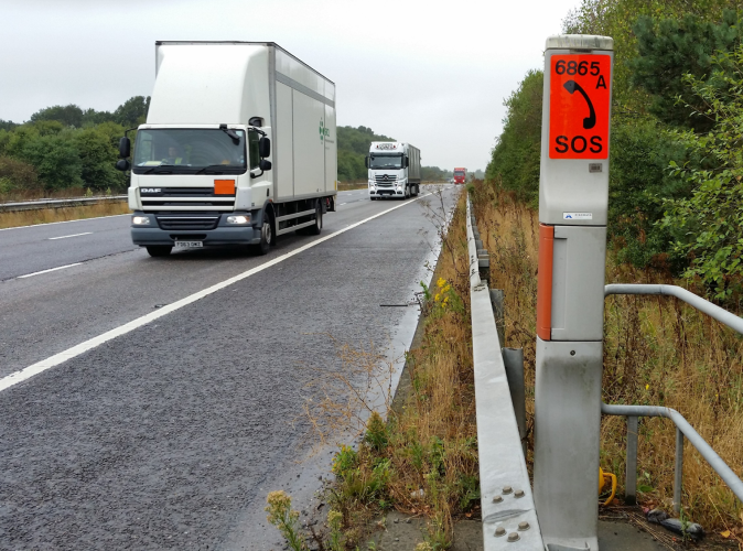
Other supporting technologies include Emergency Roadside Telephones (ERTs) provided to allow drivers to contact emergency services. These continue to be provided despite the ubiquitous presence of mobile phones in most of our lives. Technologies for emergency phones ranges from standard telephone circuits, to Internet Protocol (IP) and even solar powered cellular technologies.
Other systems are also used to provide additional data on road use, such as count and classification data, usually for audit purposes. These include a range of technologies, including temporary systems using pneumatic tubes or camera systems to permanent systems using inductive loops. This example shows an Automatic Number Plate Recognition (ANPR) system used in the UK to generate Average Journey Time information on the motorway network by identifying the time it takes for vehicles to travel from one ANPR location to the next ANPR location. This can provide good quality, virtually real-time data that can then be used by both the road operator but also to advise the public as well. Other similar systems also use identifying Bluetooth and WiFi addresses of peoples devices in passing vehicles to generate similar types of information. A recent story in the press identified a data breach from such a system which leaked identifiable number plate information to specific traffic movements. This highlights the importance of anonymisation of data at the point of capture in a way in which it is then not possible to backward engineer to identify the movements for a specific individual.
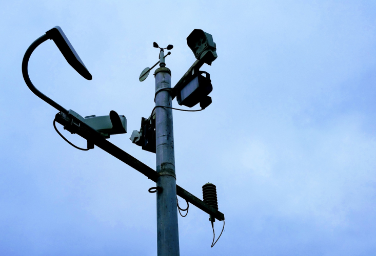
Other associated systems often used on the roadside include meteorological systems to capture weather conditions. These are often used for winter maintenance activities and to measure specific parameters such as wind speed in exposed locations. Modern systems now have capabilities to measure carriageway temperature and identify requirements for the application of grit or for snow clearance using remote sensors. Other associated sensors include air quality measurements, that range from large highly accurate systems that need to be housed in a dedicated container sized structure down to small Internet of Things (IoT) sensors which are often single parameter battery powered devices. The output from these systems can be used with traffic management systems to alter traffic flow in response to particular environmental issues.
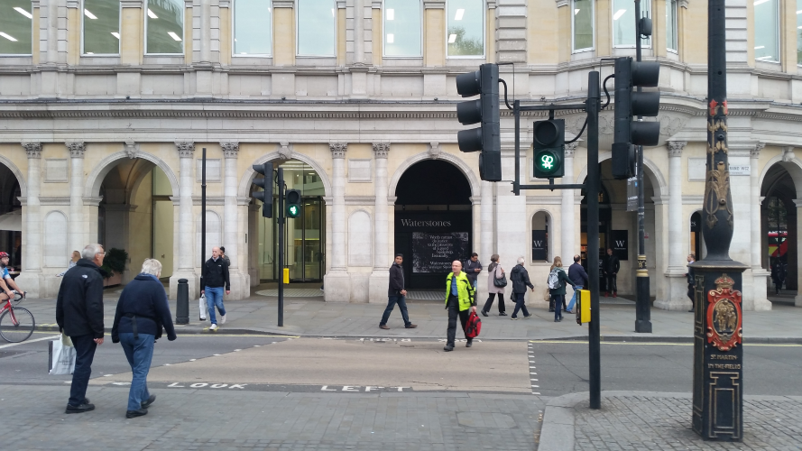
Traffic signals exist “To separate conflicting traffic by the division of time, within the spatial constraints, in a safe, efficient, and equitable manner.” The term traffic is encompassing, and refers to all users, including:
- Pedestrians
- Cycles
- Equestrians
- Public Transport
- Emergency Services
- Motorised Vehicles
The inclusion of the word ‘equitable’ in our definition above, reminds us of the way in which the emphasis has changed over recent years when considering the requirements for a traffic signal installation. In the past, it was sometimes difficult to justify the inclusion of features into designs, such as pedestrian facilities at some locations, because of the lack of perceived demand.
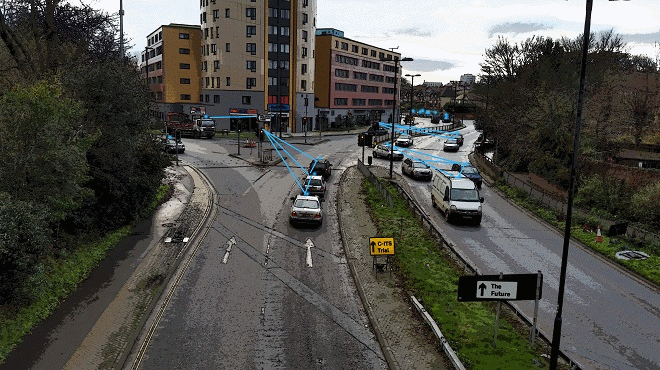
How might roadside infrastructure change in response to Connected & Automated Vehicles (CAVs)?
Looking to the future, much has been made of the impact that Connected and Automated Vehicles (CAVs) will have on the requirements for supporting infrastructure. In the future, vehicles are likely to change beyond all recognition, however the first part of this progression will be the provision of connectivity to vehicles.
This will underpin the route to vehicle automation by allowing vehicles to communicate with other vehicles (called V2V) and to the highway infrastructure (V2X). Using these communications facilities, it will allow vehicles to warn other vehicles of safety conditions, such as if they have to stop suddenly or to be informed of damage to the road network, such as a pothole!
This last example shows how technology might be incorporated within the core of the road itself, to enhance the way in which different classes of road users might interact with each other.